Getting ready to cut some firewood on the farm this morning. The snow has just about disappeared and so quickly we're dumbfounded. That only means that they are singing, "How Highs The Water Mama?" in Fargo and other points along the Red River. So, I thought I'd give you a link to a graphic of the watershed we are partial to here at Blue Moon Farm and Ranch. If you can expand the details of this graphic you'll be able to find the Buffalo River Watershed sub-basin. Follow the line representing the river in the polygon depicting the BR Watershed and just before the end of that line is Blue Moon Farm and Ranch. Wave if you can see us.
Red River of the North Watershed Basin
Lyn and I plan to drive over to the headwaters of the Buffalo River today and visit the Tamarac National Wildlife Refuge Headquarters. We're gathering some information for our granddaughter, Jaela. We're part of a school project with her and we're developing a "care" package for her so she is successful in her current job as student at Lolo Elementary School in Lolo, Montana.
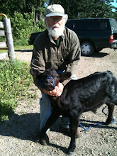
Maybe I'll check out conditions on Tamarac Lake for a little ice fishing expedition this afternoon. Right now, though, I better get out with those heifers and see if I can temper their wild genes a bit.
Sure hope you all can send us a High Pressure weather system pretty soon. This mud will not dry enough for me to level the corral and sacrifice surface areas. Need some sun upon it pretty soon or the heifers will be up to their bellies in mud. The heifers are pugging it with their hooves and making a mess of things around high use areas; the bale feeders, mineral skid-feeders and water fountain.
Do good and keep your eye on the greenside.
Tuesday, March 16, 2010
Subscribe to:
Post Comments (Atom)
No comments:
Post a Comment